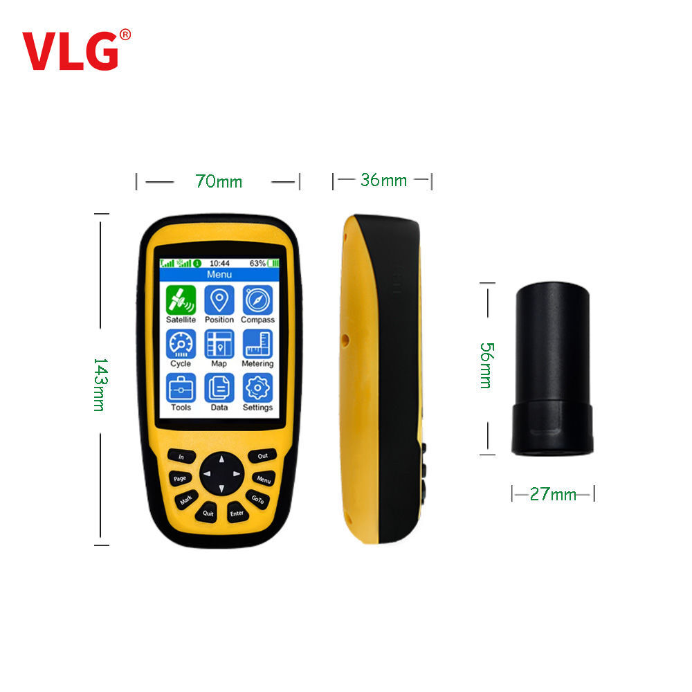
Handheld RTK meter receiver surveyor

RTK Handheld meter for positioning, Land survey, topographic survey
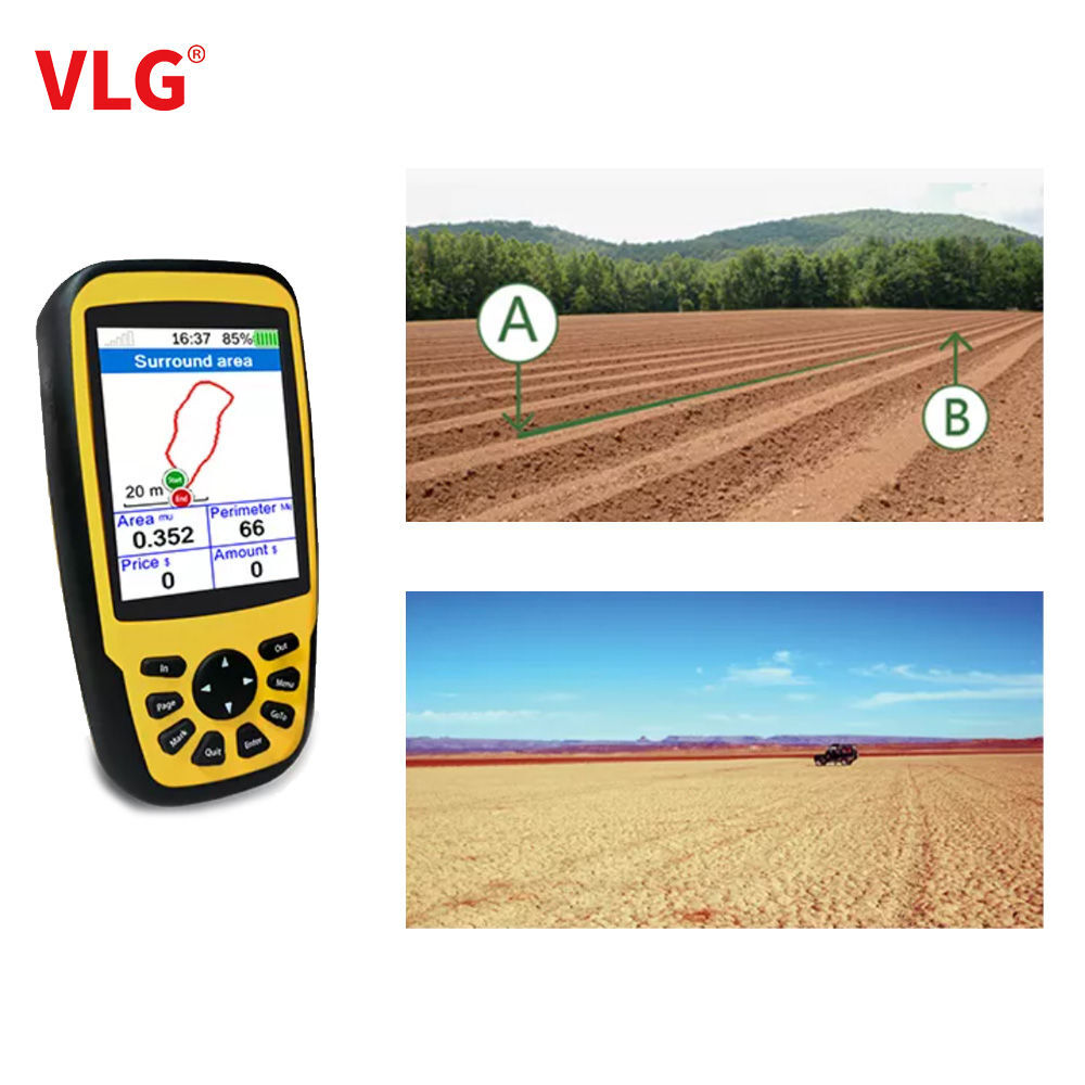
Agriculture 4 major functions
>find out water pile
Identify the water piles and collect the location of each pile before harvesting or plowing, then find the correct location to install the pile before planting
>sharing AB point
Share the AB point, and share the collected AB point data with the tractor navigator to avoid the tractor running on the ground for nothing.
>Land survey
Plot measurement, enclosing area, dot area, perimeter, curve length, straight line length
>Topographic survey
Topographic survey, minimum height, maximum height, average height, the amount of earthwork to make the plane, etc
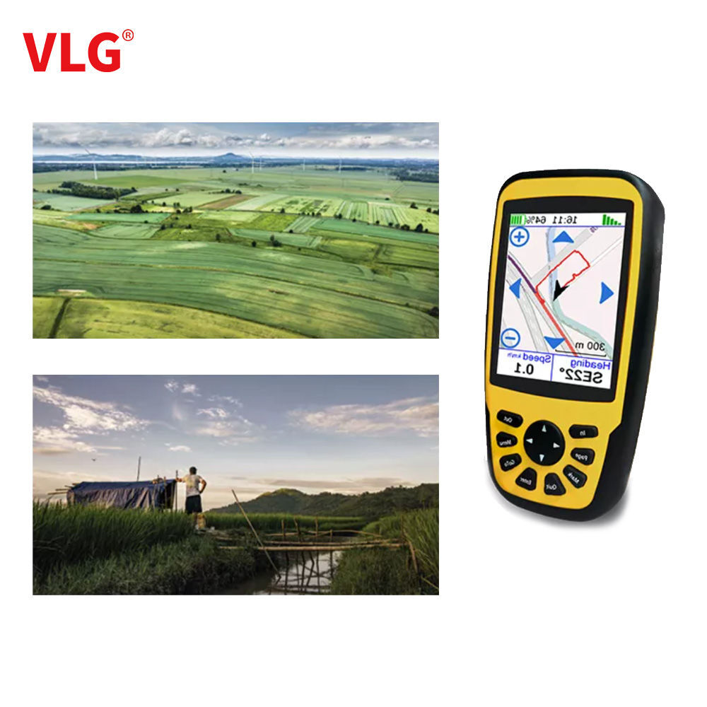

Except application on Agriculture field, the handheld RTK can also be used on outdoor exploration, which requires real-time positioning data. If you are really in trouble or injured, search and rescue personnel can quickly find us by location and give us rescue.
There is also risk of getting lost, after all, in a big mountain, once lost, if suffered also with bad weather or at night, it will be more difficult to find the way, there will be danger